
OpenJUMP
GIS data management with layer and category organization
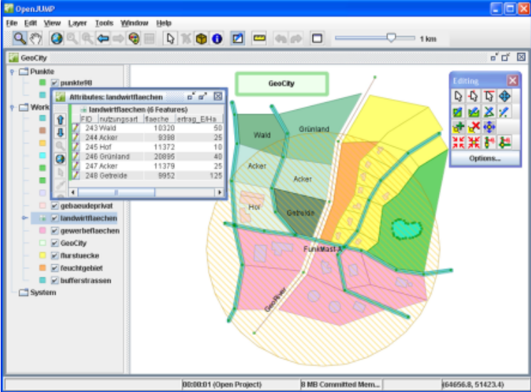
Description
Manage your GIS data effectively with OpenJUMP's project-based approach. Create structured projects with layers and categories, then edit geometry and attribute data within shapefiles or GML files. The application provides viewing capabilities alongside editing tools, with adjustable settings to enhance your spatial data management experience for both simple and complex GIS tasks.
Screenshots
Click to view full size